July 2011
Did a 10 days sea kayaking trip to the most southern part of the Archipelago National Park in Finland. This was a Swedish spoken area in Finland, i.e. archipelago in south-west, or 'skärgård' to me, on its best.
The trip was a team event with eight members from the same sea kayaking club. The team contained a Captain, a Vice Captain and six others in the crew, including me.
The trip had a theme and a mission planned by the Captain; visit outmost islands which had or used to have fishing huts. We did visit and saw several of them, perhaps the most charismatic ones. More about the fishing huts and the islands below.
The whole region was sensitive for wind, as there were no big islands to bring any shade. Basically strong wind from any directly was dangerous. Thus, security while paddling on these waters was the most important thing for us.
Although there was a predefined route plan, every morning after listening weather forecast the daily route was redecided. We could not follow predefined plan due to extreme weather conditions, i.e. too strong wind. We also had to stay one day on an island due to strong wind (12 m/s and above). Even paddling distance on three days was quite short, we did complete some 200 km altogether. The first four days we paddled towards west against headwind. When turning back towards east direction, the wind changed it direction, too, and we had a headwind again. About 80% of the paddling we had headwind, bad luck indeed.
Although wind was against us most of the time, temperature of air and sea water were not. Air temperature stayed +20C or above during nights and some days even over +30C. Can you imagine, in such far on the sea! Water temperature was +18C (or even higher) almost everywhere. Unfortunately, Baltic Sea is sick, thus cyanobacteria is commonly visible during summer times, as it was now, too.
Even with the modified route we saw and visited extremely interesting places, saw wildlife and rare nature that only few can see (these waters contain lots of rocks thus motor and sail boats cannot visit everywhere there, unless they'd be very familiar of the neighborhood).
We started and finished the trip from a harbor at Kasnäs. By last May, Kasnäs was only reachable by a ferry. A new bridge was built there and it was opened on May '11 allowing us to reach the harbor easily by a minibus.
Here's the whole route we paddled (please switch to Aerial or Hybrid mode to see all islands):
Highlights of the trip
- Alunskär fishing hut island
- Kalskär (Jurmo) fishing hut island
- Kuggskär fishing hut island
- Gärskär fishing hut island
- Saw Grey Seals in several places
- Saw sheep in a very remote island
- Saw quite a huge variety of water birds, perhaps Black Guillermot being the most common
- Mulberries (made together pancakes with mulberry jelly and whipped cream: yummy!)
More information about larger islands in this region: An Archipelago Guide.
About Fishing Huts on small, remote and isolated islands
The most important fishing season of the year used to be from mid July to end of September, to catch Baltic Herrings. That habit in this region was several hundreds of years old.
Fishermen and their families used to live in islands but never so out of the sea where this fish was easy to catch. Thus, fishermen from several regions and municipals built fishing huts on these remote islands which they could use about a short period of fishing in every autumn. About how much they caught fish during this period also explained how well their families survived over hard winter period.
Perhaps the so called golden period of this type of fishing was during the 19th century, when fishing was done using sailboats. Some easily reachable remote islands by sailboats had over 30 fishing huts (and these islands were treeless)! In the early 20th century when engines started to appear in fishing boats, need for these fishing huts was slowly vanishing (as people with motorboats were able to travel longer distances). Nowadays, only very few huts existed.
There is an excellent book about describing history of these islands with fishing huts called "Tuulten Armoilla" (sorry, in Finnish only). Nearly 40 years one family has sailed and visited these islands and finally put their ever increased knowledge into a book. Superb stuff in the book, I admire their humble and precise work very much!
Day 1
Kasnäs-Slätskär, about 2 km of paddling
Arrived at Kasnäs late evening. Purpose was just to pack everything into kayaks and paddle only few kms, just to get early start on the next day. Paddled from Kasnäs to Slätskär island. Set up tents, had a late dinner and enjoyed the moon. To get life more exiting, it started to rain during the night, getting tents wet.
 |
| Moon Bridge |
Day 2
Slätskär-Vänö, about 19 km
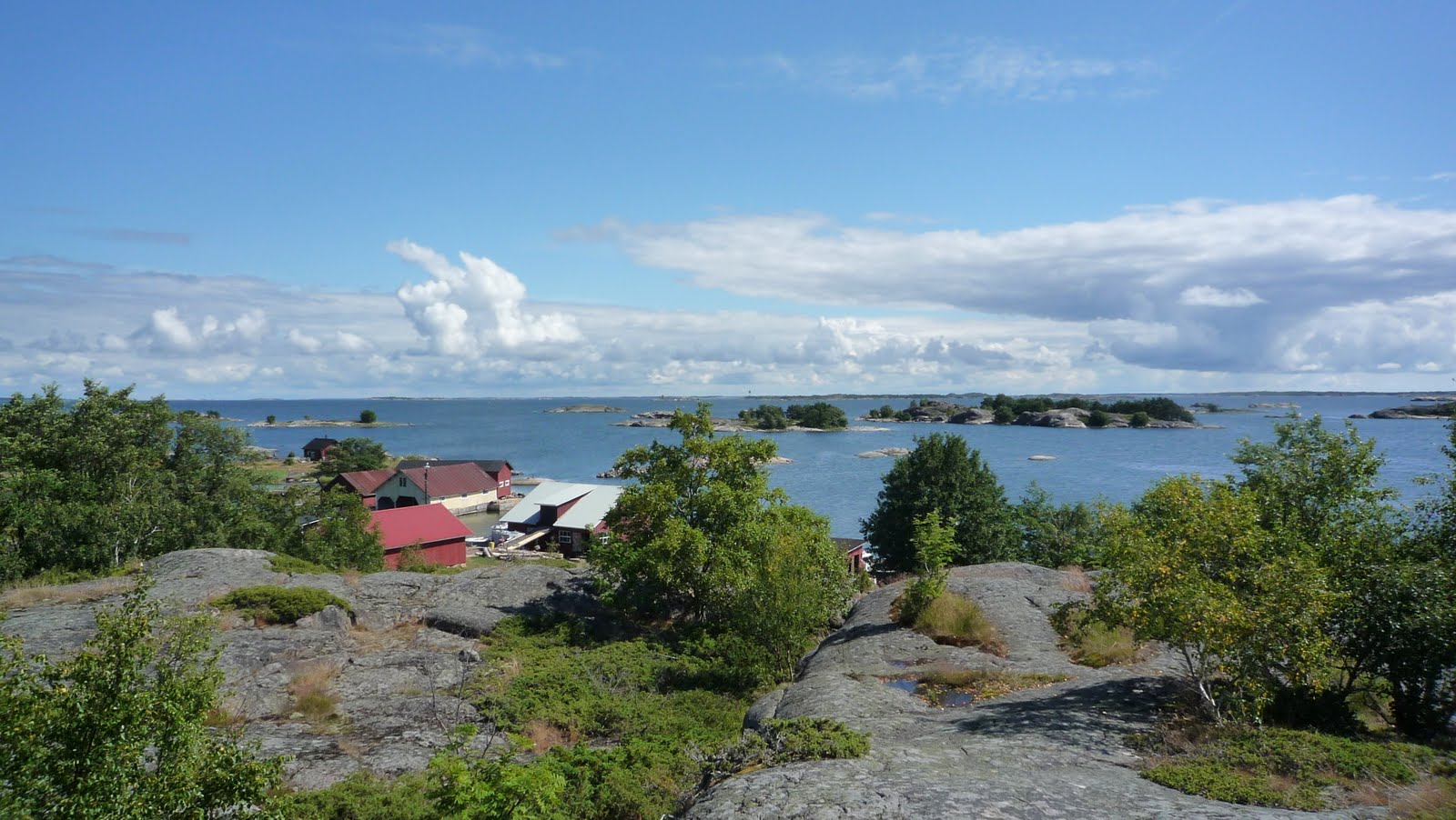
Beautiful weather but strong headwind. Had one accident while crossing first open sea, on relatively high waves, one of crew member's kayak started to drown from back deck, one of the hatches was not properly closed. Had to turn back and trail the kayak to the next island. Everything went well, thanks to our Captain's determined and decisive actions. Wind stayed strong all the way to Vänö. There was a small shop at Vänö plus ability to fill water tanks. Set up a base camp about 5min paddling distance from the harbor.
 |
| Ruins of an old fishing boat at Vänö harbor |
 |
| A new fishing boat heading out from the Vänö harbor |
 |
| A scenery from the Base Camp on Vänö island |
Day 3
Vänö-Borstö-Jurmo, about 38 km
Again a sunny day, wind moderate. After breakfast headed to Borstö island. Landed at its small harbor and visited islands famous landmark, a statue on top of the big rock. After Borstö had a short break every now and then, usually after 3 km of paddling (became a typical procedure every day). Had lunch on one of the Salskärs kläpparna islands.
Never seen or been on Jurmo island before. First impression after seeing its east end was breathtaking, such a ridge of small stones.
Paddled to harbor. There was a small village (for four families) in the Jurmo island, too, but it was not meant for visitors. Harbor had several fine class sailboats, mostly from Finland. We did meet an Aussie there, who had participated a Gotland Runt, a sailboat race, and was now sailing on these waters. He was a sea kayaker from Sydney and wanted to show us his paddling photos from Australia. What a small world.
At harbor there were couple of small shops. Perhaps once a day made smoked fish was the most popular hit of the shop (although to me it was a cup of fresh strawberries). A beautiful photo exhibition was set on outside of walls of old fishing huts near harbor. The exhibition showed photos taken (by Iina Terho) every week at east end of the Jurmo island during several years.
To me this was a very fine day. Even it was relatively long to paddle, weather and scenery were so nice all the way that I enjoyed every second.
 |
| A small village on Borstö island |
 |
| Numerous small blue shells, smell incredibly disgusting |
 |
| Wild Sea Kale, yumm |
 |
| Ex-Naval Mine, although there was a lefthand shoe near by ... |
 |
| The Base Camp on Jurmo island |
Day 4
Jurmo, 0 km, about 12 km of walking
Weather forecast already yesterday told us that we might not be able to paddle next day. This proved to be true in the morning as well. Forecast promised over 12 m/s of wind, so it became a day off from the sea.
However, temperature stayed very high on this remote island, raising above +25C in the afternoon, with full of sun shine. It couldn't have been a better place to have siesta.
Had a lazy morning and enjoyed late breakfast in one of the shops. Then visited the nature center, which gave exhaustive information about a history of the island and its nature. This is for other Finns but did you know that the island is the last part of the Salpausselkä ridge (n/o 3)? Yes, that's right. After Jurmo it still continues a while but under water level. Another detail: the island contained about 370 different species of plants, identified by one man some time ago.
Next visited on top of the highest hill, or actually a huge rock. You could see everywhere. In the east there seemed to be a forest. Yes, about the trees, the story went something like this: in the 16th century, it was told that Jurmo islanders burnt fire to give wrong signal for boats travelling near by in hope of getting them crashed in nearest rocks, just to get stuff from their boats. King Wasa heard this and ordered every tree to be burnt in the island. Only one tree survived. Current forest is planted there by human.
After church headed towards east end of the island. One couldn't reach west end as it was preserved for birds at this time of the year. In between the church and east end, the scenery was like in Lapland, similar plants, similar smell, truly amazing. Ridge at the end came smaller and smaller, finally ending into the sea. What a beautiful place in the earth it was.
On the way back was an old boat house, rocks hanging on the roof protecting it against wind.
 |
| Very good information center on Jurmo |
 |
| A forest like a garden |
 |
| Jurmo church and a graveyard |
 |
| One of the four Munk Rings, no one knows their origin |
 |
| Splash |
 |
| East end |
 |
| A lonesome |
 |
| Autumn leaf colors, this is not Lapland! |
 |
| Smelled and looked like in Lapland, too |
 |
| Ancient boat house, look at the stones on the roof! |
Day 5
Jurmo-Utö-Alunskär-Utö, about 30 km
Weather forecast promised wind but not too much. It was about time to continue, to Utö lighthouse island.
I've always imagined the Utö island to be so remote on the sea that it would be unreachable to me. In less than three hours I arrived at its harbor with other crew. What a moment! Had a lunch break there. We managed to get a Guide who demonstrated us the lighthouse from inside. Guess what, in the 2nd floor there was a church inside the lighthouse and that the Priest would visit there twice a year!
About 30-40 people used to live on this island around the year. There's a hotel, too. At its bar there were a group of divers who at day time dived into old boats near the island (who used to sink hundreds of years back). Utö waters had lots of rocks so it was common boats hitting rocks there and sinking. This island was the dream place for bird watchers, too, as many birds travel south-north via this island (although didn't see any airport for landing there).
After the break headed towards the first fishing hut island's, Alunskär. Directly after leaving harbor at Utö there started to be big surges (mainingit in Finnish) on the sea in addition to normal high waves. Surges (nearly 2 meters high) were higher so that every now and then other paddlers and islands on sight disappeared. Once you floated on top of the surge everything came back into sight.
Alunskär appeared to have a small internal harbor. Only one fishing hut was left. Even understanding the difference in water level today and 150 years ago, it's still amazing to imagine of how fishing boats sailed into internal harbor on windy conditions. Their skills were unbeatable.
Didn't understand why there were so many snakes on these most remote islands, e.g. in here we saw a Common European Viper.
Before returning back to Utö, paddled around Lillharun lighthouse island which was near Alunskär. Waves were reasonably high, but wind was now tailwind. Surfing unfortunately was forbidden.
Evening was really warm, temperature well above +20C. Had a dinner at the hotel (so my Primus gas cooker had a day off).
Sleeping was difficult in such a heat. Again a light rain arrived at night, didn't really cool the weather but brought tents wet.
 |
| Utö Lighthouse and the village |
 |
| Utö Lighthouse, chuch in the 2nd floor! |
 |
| A hut and its guards |
 |
| A fishing hut on Alunskär island |
 |
| A scenery from Alunskär island to Lillharun Lighthouse island |
 |
| Towards Utö |
 |
| A fishing boat |
 |
| A White Chapel |
 |
| A fisherman picks up fresh fish from nets |
Day 6
Utö-Ulvingen-Kalkskär-Sandvik harun-Storskär, about 32 km
Time to leave Utö after trying to get the tent dry, with no great success. The first stop was Ulvingen, a fishing hut island. Don't have much memories of it after couple of days.
However, the next stop was the best fishing hut island we saw (and perhaps the best overall, too?), Kalkskär (Jurmo mentioned there, as there are many with the same name). What made this island so special? Well, difficult to say, you have to see it :) However, huge variety of different style of stones mixed together in ice age, several small giant's kettles, no trees, one old fishing hut, small internal lakes etc. Perhaps weather helped our decision, too, staying near +25C.
You don't see people often on these islands, not to mention paddlers.
From Kalkskär we continued to Sandvik Harun, a fishing hut island. This was mentioned to be a real pearl of the region. The island had five huts. There was a group of men renovating currently some of the huts. I have to admit that I didn't find this island so attractive. Nothing to compare against Kalkskär, sorry.
From there we continued to our base camp island, Storskär. It's neighbor island, Kalksär (not Jurmo!) was a fishing hut island. Once we arrived, set up tents, went swimming (like every day, as water temperature was about +18C everywhere there), and cooked dinner. Some ones spotted lots of mulberries (Hilla or Lakka in Finnish), picked them up, which we enjoyed a day later.
We saw people arriving at the fishing hut island by boat. One of them came to see us, she was a sea biologist. They studied quality of sea bed near by. She came to visit us to tell that we were in an island which was prohibited to land, around the whole year. Even waters near by were prohibited. However, she didn't ask to leave immediately, but the next day. It appeared that the area was a preserved area for nature. It was not mentioned in any maps, only in their brochures she was carrying with her! It's sometimes pretty difficult to plan travelling routes if preserved areas are not printed in your up-to-date maps. However, that's not an excuse, one should have taken this type of thing into account when planning the trip.
 |
| Small giant kettles in Kalkskär |
 |
| Ancient fishing hut in Kalkskär |
 |
| Where to tie your boat, some 150 years ago |
 |
| Hooked |
 |
| Did Ice Age know what to do? |
 |
| Fishing huts on Sandvik Harun island |
 |
| Lots of these on Sandvik Harun |
 |
| A Grey Seal |
 |
| Went swimming, air's too hot |
 |
| That hut doesn't slide! |
 |
| Fresh Mulberries and we're some 1000km from Lapland! |
Day 7
Storskär-Gärskär, about 15 km
This was a lazy day. As wind proved to be strong in the morning, we waited until noon before started paddling. Leg was only 15 km to the next fishing hut island, Gärskär.
Set up tent and go to swim, was the procedure. In the evening we made pancakes, ate them with fresh mulberry jelly and whipped cream. How good they tasted!
Sunset looked really nice. Heat was still a problem for me, couldn't sleep well in over +20C night temperature.
 |
| A paddler having a siesta |
 |
| Sunset on Gärskär island |
Day 8
Gärskär-Vänö-Kuggskär, about 25 km
Ringing bells woke me up in the morning. From the traces on the island I noticed that there had to be some sheep, waste was so fresh. They stayed under the wind, so perhaps they hadn't noticed us yet. Slowly they moved closer to us, eating all the time.
Once noticed us they stared us as being totally surprised. They didn't escape, but came closer and closer, and stared and stared. Didn't know what to do, would they attack or were they only curious? It appeared to be the latter. They were really nice, interested in first myself and then about my pocket camera. First licking it, but soon wanting to eat it! Could have stayed all day with them, but had to unpack all stuff and jump into kayaks.
Had a break at Vänö harbor, filled water tanks and bought some fresh bread at the small shop. Weather was again brilliant, pure sun shine, and well above +20C.
Already near Vänö there started to be more and more islands. After Vänö we crossed a longer open sea (head wind as usual) and then jumped into a jungle of islands near Örö military island. But before Örö we had a lunch&swim break on Gloskäret island. There were lots of small jelly-fish, but were harmless, although annoying while going to swim.
After lunch break Vice-Captain lead us into the real jungle of islands. Orienteering went well as we soon reached our target, Kuggskär fishing hut island. This was a remote island, thus wind was quite strong there and finding a peaceful place for landing was quite challenging. All went well and eventually we had our base camp set up.
We knew now that open seas were behind in this trip, sadly to notice it. Soon started to appear more and more island with thick forest. That's not what we were looking for.
 |
| You guys know Wallace and Gromit? |
 |
| Kuggskär island |
 |
| Sunset on Kuggskär island |
Day 9
Kuggskär-Bengtskär lighthouse-Lillholmen, about 29 km
Saw thunderstorm approaching our base camp. There's no need to ask crew to unpack tents ASAP. All did it on time. Then the sky opened, heavy rain with lightning, real thunderstorm. In about 30 mins all was over. Weather forecast mentioned quite strong wind. However, our Captain suggested that we'd go out from our safe haven a bit to see how strong the wind actually was.
Thus, started to paddle towards Ljusskär island. Wind didn't prove to be very strong, just moderate. Due to open sea, waves were quite high, though. Decision to paddle to Bengtskär lighthouse island was quickly made. One of our crew member didn't want to go there so a lonesome paddler was left to island. A bit longer lunch break.
Distance was about 7 km, just open sea with a couple of rocky islands. Had one break but didn't jump out from kayaks.
When arrived at the island, waves and surges were strong. Island Guide instructed and assisted our landing, which I have to say was really challenging.
Bengtskär lighthouse was the most south place where people live in Finland. There's one family who run the place, e.g. a small hotel and a cafeteria. Of course there was a one-room church, too! Ferries carried tourists once or twice a day from the city of Hanko (about 1h 30mins by boat).
Border of Finland was quite near there. There was an Army boat floating near by surveilling invisible borderline. Could there have been Russian submarines? That's the only thing missing from our trip I was keen to see! No luck at this time.
Checked weather forecast before returning. It promised moderate wind, so it looked pretty good to return. However, when starting to prepare to put kayaks back into water, noticed that a thunderstorm was raising from south towards us. After 30mins of paddling the wind raised a lot and it started to rain. Luckily for us the lightnings hit south and east from us, and were not coming towards us. However, it did raise wind, and thus waves, quite a lot. After 20 mins of waiting started to paddle again (we stayed in our kayaks all the time). Pretty challenging paddling. Everything went well, though. Picked up a lonesome paddler from the Ljusskär island and continued paddling towards our last base camp island, Lillholmen island.
There seemed to be a summer cottage in the south end of the island but we set our tents to north end. We new that Everyman's Rights allowed us to land there and to stay overnight. Cottage people visited us and gave welcomed wishes.
Set up tents, went swimming and prepared a dinner, that's the procedure for the last evening (was it different from earlier days? I don't think so). Rain had stopped some time before we reached the island and very warm evening with sunset was welcomed.
 |
| Bengtskär lighthouse |
Day 10
Lillholmen-Rosala-Kasnäs, about 14 km
A bit sad feeling in the morning, knowing that this was going to be the last day. There was still one visit to go, i.e. Rosala island and its Viking Centre. Not sure about Vikings here, but it demonstrated Iron Age, the age Vikings used to rule in Nordic regions (at least). However, as we wanted to complete this trip soon, we decided to just have a cup of coffee and jump back into our kayaks.
Off we went and in less than two hours we were at Kasnäs harbor, on the very same beach we had started our trip ten days ago. That was it!
Backed our kayaks into a wagon and drove off the island back to the main land. In about two hours we were at our club house to empty the wagon.
Epilogue
Was it worth doing it, this sea kayaking trip? Wrong question, of course it was. Was really nice to paddle several days together with other team members, lots of time to chat this and that with everyone while paddling. We were able to keep the same rhythm and speed all the time, that's pretty important. Big thanks to our Captain and Vice-Captain about well made and organised trip! Many thanks to ALL crew members for the fine experience!
Southmost region of this National Park was worth to explore with sea kayaks. There haven't been many people visiting these islands before by kayaks, so it was quite a rare situation. Been now quite honored to do so.
Best places to see? I'd raise four places: Jurmo and Kalkskär islands, as well as Utö and Bengtskär island with their lighthouses. Grey Seals on live were pretty awesome to see, too.
What did I eat during the trip? Well, have to admit not very culinaristic stuff, though. In the mornings, porridge, a pot of coffee (Parisian roast or Espresso, in presso pot), one or two scrambled eggs on top of two slices of rye bread and some fresh orange juice and yogurt. At lunch usually only an energy bar, different type of nuts and raisins as well as some coffee (made in the morning and stored in a thermo bottle). In the evenings, I cooked a hot meal, pasta or couscous with different sauces. Some fruits and sweets, too. During the day I usually drank water, lots of it. Sometimes I made some so called sports drink, to get natrium levels right.
Was I tired after the trip? Physically not. Mentally certainly not, as batteries seemed to be fully charged!
Do I regret something from the trip? I do, one thing very much, i.e. I didn't keep up notes nor daily diary at all during the trip. One tend to forget things soon, especially I'm the one who does so.
Sounds like a very nice trip. Nice photos as well.
ReplyDeleteThanks a lot Yeti!
ReplyDeleteWhat a great looking trip! If I'd just have more time, I'd love to learn sea kayaking skills too...
ReplyDeleteThanks a lot korpijaakko! To speed up learning, take a 2-3 day course by some local kayaking club, or in the meanwhile check out theory e.g. at www.melontaopas.fi
ReplyDeleteInteresting post! Many new things I did not know before. Nice videos too!
ReplyDeleteOutdoorsfinland many thanks again!
ReplyDelete