31 December 2013

Summing Up My Outdoor Year 2013

December 2013


January


My outdoor year 2013 started slowly in January. First activities were walks on nature. Walking on the coast has always been inspiring, like watching these ice skaters at Kallvik:


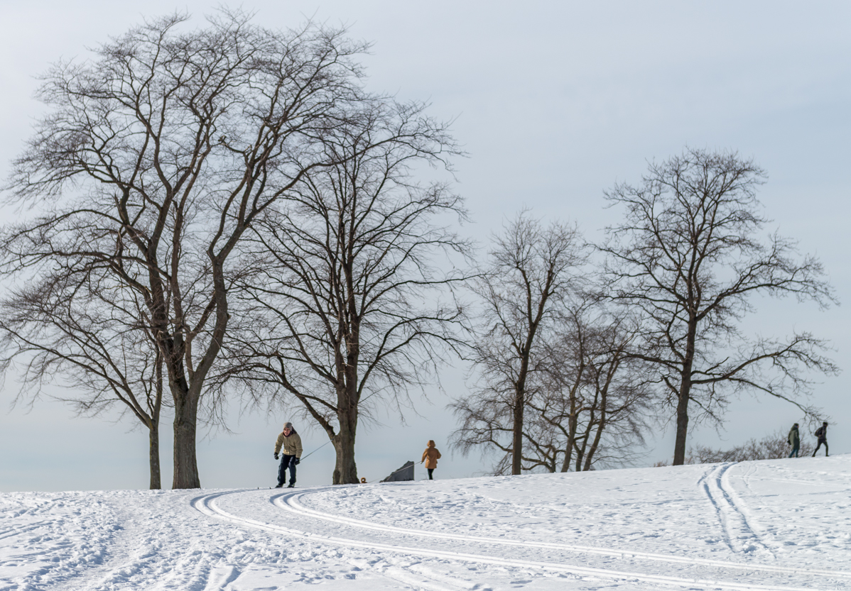
Did some snowshoeing at Vaakkoi, too:


Cross country skiing, running, walking, snow shoeing, these were prescription for outdoor cure.

February


February was a lazy month for outdoor activities. Something was about to change.


March


Got a new job offer in Autumn 2012, considered it a while and then finally accepted it. It was about to move from Finland to the California, US (where this post is now written 10 months later).

Lots of plans for different outdoor activities were flown in mind. However, started from the easiest ones, walks, cycling and some hiking.  Ultimate plan was to search and find a sea kayaking club were to join ASAP (unfortunately that search is still active).


California offered some cool State Parks near new home, like Torrey Pines:


On the beaches one could see many species of birds as Pelicans, as well as seals:


April


In April continued walks on different beaches. Did few day hikes, e.g. to Palomar Mountain and Hellhole State Park. (Outdoor) Swimming came back to weekly agenda, too.


Had bought a new road bike earlier in March and started to grow miles with it on local roads. These roads were not flat, but very hilly, including mountains over mile high.  While having hikes on trails had noticed them to be most suitable for mountain biking. Soon after on May a new mountain bike found its place from a garage.


May


May was filled with cycling, as bike commuting finally was started. Pro cyclists visited us while the first stage of Tour of California cycling race filled the streets in Escondido:


Day hikes scheme continued, bringing new places as Elfin Forest, Los Penasquitos, Iron Mountain, Volcan Mountain and San Elio Reserve.


June


On June, any outdoor activity (except swimming) had to be started early as heat hit hard at 10am by latest. Wanted to experience the real heat, too. Drove over the mountains to Anza-Borrego desert State Park. The temperature was +43C.  Did a short hike there and that sure was enough. Did first hiking on Pacific Crest Trail (PCT).


Did a lot mountain biking on June:


July


On the fourth of July weekend headed even further to the mountains. San Jacinto, peak over 3000m, lied on two hours drive north east from San Diego. Idyllwild, a cool hippie town on mile high had some great lodges. Did mountain biking and hiking, conquering San Jacinto peak.  On San Jacinto Wilderness, took more serious hiking on the PCT, too.


The rest of the July was filled by city walks in San Diego and LA, as well as road and mountain biking. An injury in foot did not allow any serious running.


August


In August started to join in cycling races and events near San Diego. The first event, CycloSDias, was an event promoting city cycling. The next one, Bike The Bay, was a bit more serious, crossing A Coronado Bridge.


September


In September did the first more serious cycling race, Giro di San Diego. Some heavy climbing on the road. Tough but rewarding. Continued city walks on small cities north of LA.


October


October started with another cycling race, Tour of Poway. Legs were empty on first mountain, Happy End. Otherwise spent reasonable time on a mountain bike saddle, too.

Explored new mountain region, east of San Diego, called Laguna Mountains. All trails there were over mile high in altitude. Did some hiking and mountain biking there on consecutive weekends.


Autumn was truly visible there, too. Leaves of sudden oak trees were either red or bright yellow throughout pine forest.

Cycling, new city breaks and a day hike on Santa Ysabel were in agenda.

Another PCT experience took place in Laguna Mountains, too. Near the edge of mountain, one side showing meadow and forest of Laguna and another edge Anza-Borrego desert.


November


November started with another cycling race, Tour de Julian. The real mountain race. Again, empty legs after the first real climb. And again, the very Happy End.

Did another hiking near Laguna, on Cuyamaca mountains, containing the highest peak on San Diego County.


Probably the best hiking took place later in November in Joshua Tree National Park. This legendary NP did show its best. Rock climbing there looked absolutely tempting, who knows if ...


December


Among cycling, December contained city and beach walks as well as a relaxing holiday on Oahu island, HI.


Summing Up


GPS recorded altogether some 3000km where most of it came from cycling. As a great disappointment, there was no paddling activities recoded during 2013. Hope that's going to change in 2014.

The best photo I took during 2013?  I would pick up this one as it explains pretty well the sight which have become more and more familiar to me during 2013:


Happy New Year!


07 December 2013

Cabrillo National Monument Centennial

December 2013


The Cabrillo National Monument had its 100th birthday this year. It was one of the first National Parks created in the US, as it was established 1913.  The Centennial celebration were postponed due to government shutdown earlier this autumn, but continued now in December.

Walked around nature paths and checked tide pools. Had an opportunity to visit inside the old Lighthouse, even at the very top on the tower.  Probably the highest point in Point Loma, there's a good view over the city of San Diego. On a clear day one could have seen snowy mountain tops in the east.

The Army had its annual celebration there, too. People were in WWII costumes, looked pretty authentic to me.

It's a nice place to visit, though quite small. Soon, gray whales arrive and it'll be one more reason to visit there again.


Photos


Welcome!

Signor Cabrillo, in honor of landing here in 1542

There's no fortune at the end, but a Navy vessel

The Old Lighthouse

The Chief of the Lighthouse

The staircase of the Old Lighthouse

Glass in the tower, stunning

Guardian of the window

Christmas has arrived

WWII airplane circling around Cabrillo

Pipe's cool

Sunday walk

06 December 2013

First Hike on PCT


October 2013


A true multi-day hiking on Pacific Crest Trail (PCT) has been on to-do list a while (not thru hiking yet!). Realizing it'll still take some time before materializing the plan, wanted to get the real touch already now on what the trail looks like etc.


The whole PCT trail starts near from Mexico border and continues northbound some 4000km (or vice versa). One can do an hour, a day, two day, a weekend, a week etc hikes on it.  Permits are required on some parts. Doing over 500 miles continuous hiking requires a long distance permit (which is free).

Had earlier hiked few miles on PCT at San Jacinto Wilderness, but never more south.  The trail was accessible only by less than hour's drive from my home so why not to do a day hike or so.  Decided to hike near Mount Laguna, where the trail still went through pine forest before it landed on to Anza-Borrego desert. Also, it's altitude was about 1700m or above which gave a better feeling than similar on sea level.

Went to Penny Pines on Mount Laguna, where the PCT almost touched Sunset Highway. Here, the land had been burnt some time ago. Landscape looked naked, pale.

Weather forecast had hinted cold but sunny weather. Thus was carrying a fair amount of clothes; merino long sleeve shirts, a fleece, a jacket, couple of buffs etc.  Had earlier bought new shoes for hiking, Inov-8 255's (they were awesome, but see epilogue ...).  A thermo bottle of french roast coffee, with some Finnish rye bread sandwiches, coke and stuff.

Decided to do a back and forth hike, getting even better feeling to the trail as seen from both directions. Near Penny Pines, there's an official(?) check point of the PCT, called "NobleCynTr" (i.e. Noble Canyon trail junction). These "official" check points were marked in PCT maps. From the very same place started one of the best mountain bike trail, Noble Canyon Trail (mtb not allowed on PCT).

From the starting point headed southbound. There's a descent towards east where the desert laid a kilometer lower of the trail.


The PCT trail went on the edge, safely though. The land was burnt all over, leaving an odd feeling.


The trail went first down before it started to climb towards tops of nearest mountains. Bypassed Sierra Club's Lodge.  Weather became warmer and warmer, it was about time to continue with a thin merino t-shirt.

The trail was like a single track trail, good for hiking, a bit dusty though. No major erosion on sight. Passed the next check point, "FosterPtTr".

Soon burnt area ended and one entered into a mountain slope with full of Manzanita bushes, those ones with a dark red body.


Higher the trail went one started to see better towards west, too. There was Laguna Mountain Recreation Area, where Fall foliage was showing of its best.


Once Manzanita bushes ended one entered the next zone, a mixed pine and oak tree forest. It did look really nice in there. Huge cones here and there.


Continuing further the trail went quite flat in the forest. There was a connection point to Recreation Area, A Big Laguna Trail joined the PCT, and it was the PCT check point, too, called "BigLagunaTr".

Fall foliage looked really nice here.


After 10km of hiking arrived at a Desert View camping site. It did provide a stunning view to the desert, too. Time to enjoy coffee and sandwiches and then headed back.

The trail did look a bit different when returning. Maybe there was just so much to see that one never got bored.  A few colorful flowers were still on bloom, Woodpeckers did their work here and there, hawks hunted near by. There was a significant amount of butterflies working, too.


Wind had secretly raised while hiking in a shadow in the forest.  It felt a lot stronger while reaching bushy mountains and especially on a burnt land mountains. Saw only few fellow hikers.


Didn't feel to exhausted when arriving back to the starting point, some 20km altogether. Was really worth of having a sneak peak on PCT.


Epilogue

Inov-8 Trailoc 255 shoes were really great, except I had done one major mistake when buying them, they were size too small.  On a flat section one didn't notice anything , though bit though. But when descending mountains, toes backed in front too much hurting a bit, a bit more and so on.

There's one great thing within the outdoor stores in the US, i.e. one can return equipment and get refund.  I just wanted to exchange them to one size bigger. Unfortunately the shop didn't have any size anymore, neither couldn't order them. Felt disappointed, but only few seconds until spotted Salomon Fellraiser shoes on shelf.  Got full refund on Inov-8's and bought Fellrailser shoes. They were slightly thicker but thin enough and really good on hikes (have now used them few times). Happy end.


18 November 2013

Hiking and Mountain Biking on Mount Laguna

October 2013


Hiking


Had heard about Laguna Mountain Recreation Area earlier but didn't know what to expect. Less than hour's drive east from San Diego it was pretty close after all. After a short study of map revealed place to be on a mile high with full of trails. What's more, the Pacific Crest Trail went near by, too.

Went there for hiking for the very first time.  Parking on Scenic Highway required a parking permit. Had earlier bought an annual permission, called Adventure Pass. The weather was a bit chilly but sunny. Was pretty sure the sun would warm air during afternoon.

Started hiking from Meadows Information Center. There was a trailhead which headed towards Laguna Meadow.  All trails were single track trails. Left most trail was for hikers only, Sunset Trail. Other trails were used by mountain bikers as well.

The whole region was high in altitude, on about 1600m above sea level. You felt that while keeping up a good pace. The trail went up and down, pretty smooth like hills. Noticed almost immediately that fall foliage had arrived there. It was mostly a forest there. Old pine trees were companied by even older oak trees. Oak trees had bright yellow leaves. Spectacular view.

Soon the Sunset Trail came near a small Water-On-The-Woods pond. From there one saw a meadow for the first time. Continued the Sunset Trail more north to the end of the meadow on the north. Now the trail went near the edge on the west side, giving panorama views towards Pacific. Hazy weather didn't give clear view to the sea. Now there was a little bit more up and downs but in general the trail was conservative.

Landing from the forest to the northern part of the meadow changed terrain to quite flat. There were horse riding groups, mountain bikers, hikers and few trail runners.

Decided to turn back via east side of the meadow. The name of the single track trail changed to Big Laguna Trail. Those massive old oak trees looked awesome.

The trail continued near but off the meadow. Big Laguna Lake had some water on it. Ducks were playing there. Continued then towards Little Laguna Lake, still staying on Big Laguna Trail. That tiny lake was empty of water.

Couple of energy bars filled a short lunch time. Sweared to bring proper food next time.

Crossing the meadow brought back to a mixed pine and oak forest. After about 20km hiking returned back to the car.  Mount Laguna had impressed me. Promised to return ASAP, but with a mountain bike.


Mountain Biking


Had to wait comeback for the next weekend. Weather luckily remained the same, chilly morning but sunny, warming up till the afternoon.  Fall foliage was even better than a week ago. Yellow pigment burst through leaves.

Left the car to the same place and headed to the trailhead. This time the one that was allowed for bikers.  Hard sand single track trails, no major rocks or roots on trails. Just perfect for riding. Followed Big Laguna Trail on the west side of the meadow. After meadow continued more north to Penny Pines trailhead.

From Penny Pines took a sneak test ride on one of the most popular mountain bike trails on earth, Noble Canyon Trail. Lots of small rocks on trail, quite technical. Wasn't too comfortable and soon took another trail back to the meadow.  One day will finish the famous trail for sure, let it rest for a while.

Back on Big Laguna Trail and then circled via several camping sites. Might be a good idea to come camping there, for hiking and maybe for snowshoeing at winter time?

Now a more proper lunch under a massive pine tree; some fresh rye bread from Finland and a pot of French Roast coffee.

After break headed towards pine forest on east side of the meadow. The trail started to ascend. Heavy breathing a while. Circled on few different trails coming down and soon back. Fantastic place for riding, especially Chico Gatos Ravine trail.

After few hours and some 50km of riding headed back to the car. Must return was in mind.


Photos

(all photos here)


Laguna Mountain Recreation Area


Fresh acorns ... 

... Escaped ...

... Hided

Red, Yellow, Geeen

A scenery towards west

Water-of-the-Woods

Markings

Sunbathing

Action on meadow

Pine forest

Arriving at the Laguna Meadow

A fence

A corner

Lunch eaten

A scene

In a shadow

Hikers

Fall foliage

Big Laguna Trail

Crossing Laguna Meadow

Future fossile

Single track trail on meadow

Mountain bike trail on pine forest

A ride in action

Old oak trees