February 2014
Had earlier done one
hike on Cuyamaca State Park, mainly staying on northern part of its trails. Decided already then to return soon to its middle or southern part.
Starting point was at the Visitor Center. Clear blue sky in the morning, pretty warm. Forecast predicted some clouds and increasing wind (always an issue on mountains). Some food and hot coffee in backpack. Ready to go.
Near a trailhead there was a small creek going through the valley. Surprised to hear sounds of running water there. Too many streams been dry recent weeks. Crossed the Sweetwater creek and headed north east on East Side Trail. After a mile turned east to a narrow valley/canyon.
Trail changed to Harvey Moore Trail, following the valley and almost dry Harvey Creek. After crossing the creek the trail started ascending, zig zagging left and right heading now south. There was some 800 ft of ascending. Mountain slopes had high bushes and few dead trees. This area burnt down badly a few years ago.
It's always nice to go hiking on new areas. Even how well one study maps and look at photos on social media, the real physical touch feels much better, and what's more, it usually brings positive feelings and surprises. So was the feeling once arrived on top after sweating about half and hour. Now bushes were gone and were replaced by high pine trees and long grass.
Next pine trees were gone and the trail entered on a meadow. Highest point was behind and had done only one third of planned distance.
Soon noticed some shadows behind small trees. Half a dozen Wild Turkeys wandered there looking for something (food if I'm not badly wrong). This was the second time to spot Wild Turkeys. These stayed much closer and now had a chance see their colours and feathers better. Tried to take some photos from distance, didn't want to disturb their life too much. Their colour fitted well on the background, hard to spot had they stayed without moving.
Seeing some birds cheered even more. It was time for a break. Some sandwich with hot coffee tasted so good not to mention cookies.
After lazy break continued Harvey Moore Trail which descended now towards west still staying on a meadow. Met one Lady earlier on the trail who recommended to take Dyar Spring Trail back to the Visitor Center. She was absolutely right. Trail descended still on meadow, but there started to be old oak trees here and there. Soon more and more, some of them grouped creating like a mini forests.
Suddenly saw a Mule Deer standing behind one of the oak trees. It stared at me. It was like a duel from old westerns, who's quicker, me with a camera or a deer running away. Slowly took a camera, begging 'don't move' multiple times. After first click it started to ran away. Managed to take a couple of more clicks. Thanks!
First thought that the Deer was alone as no one else followed it. Didn't see where there other Deers behind oak trees, but luckily kept camera ready as one Mule Deer after another ran behind trees to opposite direction, about 15 of them. They ran pretty fast away from me, swinging their white tail. In few seconds they climbed nearest hill and stayed there behind oak trees. Too far distance of taking proper photos. Soon noticed another group of Mule Deers approaching other group from another direction. Now the group size was about 30. Pretty amazing view to me.
Btw, to me 'camera ready' while hiking means: powered on and battery still strong, usually f4 aperture, high enough shutter speed raised by ISO, plenty of space in memory card and no lens covers.
Continued Dyar Spring Trail which was now heading towards north. Chatted with some other hikers. Really friendly people here on trails. Next came a couple of horse riders. Pretty noble view, riding on high mountain trails, must be a fantastic feeling.
Coming more down meadow ended and now oak and pine trees were combined as a constant forest. Hawks glided above, little birds had group singing, though hidden in bushes.
Took one more extra hook and turned into Juaquapin Trail. First the trail crossed a small meadow and followed Juaquapin creek. Soon forest ended, and high bushes took over. Obviously there's been a border of fire.
Crossing finally Sweetwater creek brought back to the Visitor Center. Had a short discussion there with friendly hosts. Got several good hints on Mountain Lions, places where to see more Mule Deers, Eagle spots and so on.
The 2nd hike Cuyamaca State Park was over. Looking at map (i.e. a waterproof Tom Harrison) revealed there was still some areas in the park which had good looking trails. Thus, third visit pending.
Where the first hike was a kind of a test for
new lightweight hiking shoes (for easy terrain and fast hikes), this second hike was a similar one. Had bought a
Lowa winter hiking boots and wanted to test them in easy but steep enough trails. They did work well, hopefully being able to cast them on snow later this winter/spring.
Altogether the loop was about 20km.
Some photos
 |
| Welcome! |
 |
| Meadow on 4000 ft |
 |
| First glimpse of gorgeous pine trees |
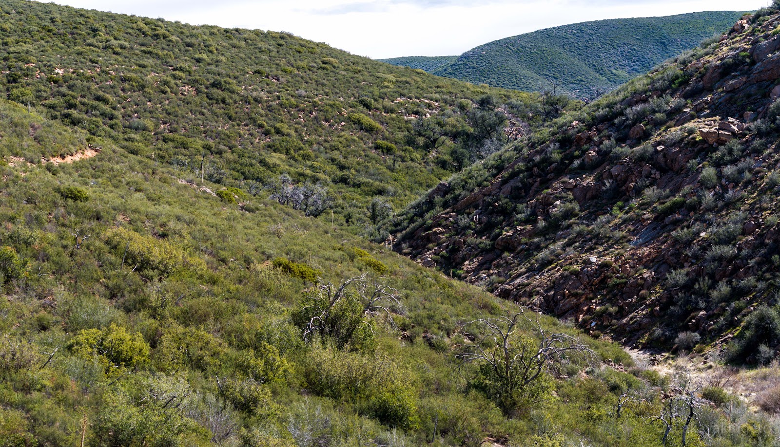 |
| Treeless canyon, hiking trail going up and down |
 |
| Girls on hiking trip |
 |
| Signs of massive fire, though a few years back |
 |
| Can't imagine this picture in colours |
 |
| Not by a machine gun but Woodpeckers |
 |
| Bright yellow flowers strike from terrain |
 |
| Oh boy, Wild Turkeys! |
 |
| Coffee and stuff, note the size of cones |
 |
| Harvey Moore Trail |
 |
| Mule Deer, running style is pretty impressive |
 |
| More of white tails, some with big horns |
 |
| Old and massive oak trees |
 |
| Dyar Spring Trail |
 |
| A closer look on a trail |
 |
| Let's call it a bush |
 |
| It's all about pigment which matters |
 |
| Yippea-ki-yea! |
 |
| Stonewall Peak |
 |
| Where's moisture and sunlight there's green plants |
 |
| Old Visitor Center |


