Hiking Muir Woods - Mount Tamalpais - Muir Woods, California
May 2011
Instead of spending time on Sunday with thousands of other people in sightseeing places in San Francisco, headed north to see huge redwood trees in Muir Woods National Monument. It's actually a forest of redwood trees in a valley. Trees were huge, almost 100m tall and about 1000 years old, magnificent, so surely a monument itself.
Just to see these trees was only one part of the plan, the whole idea was to hike from there to top of Mount Tamalpais (east peak) and to return back to Muir Woods. And to do the hike with Vibram FiveFingers shoes (model KSO). Had a spare pair of shoes with me in a backpack, in case FiveFingers would have 'destroyed' my feet, but never needed them.
The hike was all together 19km and did it in 5 hrs 30mins. Had no major problems with my feet with these shoes on. Wearing ordinary shoes immediately after the hike felt so weird. Will wear these shoes more this summer in Finland (maybe even to try to run with them?).
Along the road to Muir Woods were lots of big eucalyptus trees. Did they bring a smell of lavendel? Nice looking trees to me, exotic ones.
The Hiking Route
A ticket to Muir Woods cost 5 dollars. Asked some advice for optimal hiking route to Mount Tam. The Lady at the ticket booth was friendly and gave me good hints for right route. The starting point was 150 ft above the sea level. Had bought Mount Tam Trail Map earlier, which showed hiking trails, their distances etc.
At first in the Muir Woods, there was the Main Trail which continued about 3 km, practically flat all the time. All along the pathway there were these magnificent old and tall redwood trees.
Turned right to Fern Creek Trail, climbing started there, having steps in some places. Very nice soft terrain path, big trees brought shadows. Continued less than 1 km and turned right to No Name Trail. Again after less than a 1 km, turned left to Ocean View Trail which went towards the Panoramic Highway and merged to Panoramic Trail. The trail came to the road itself at Mount Tamalpais State Park sign near Mountain Home Inn.
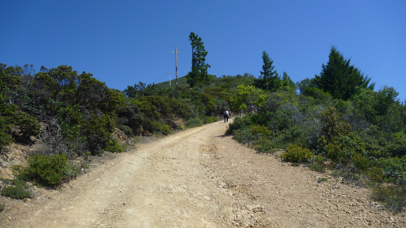
After 200m crossed the asphalt road and followed other people and mountain cyclists on a sandy Hogback Fire Trail road which started to ascend steeply towards the peak. After less than 1km came to T-junction, took a left turn and continued a sandy Old Railroad Grade road again less than a 1 km. This road was not steep anymore and seemed to be popular for mountain bikers. At a U turn, with some tall redwoods, turned right off the road to Fern Creek Trail which was a steep shortcut to east peak.
The shortcut ended near Mount Tamalpais State Park Visitor Center. There was a car park full of cars, mountain bikers and some hikers, too. Took a good sip of water, filled in water bottles and continued to East Peak of Mount Tam, having less than a 1 km left.
There was a hut on the peak but it wasn't open. Scenery from there was spectacular. How small cities of Sausalito, Berkeley, Oakland and San Francisco really showed from there. The East Peak was 2571ft above the sea level. From Muir Woods to the top of East Peak was about 8km and took about 2h 30mins.
Back from the East Peak until the Visitor Center the trail was the same. Then decided to follow less steeper road back to Mountain Home Inn to save power in legs and feet (my problem in mountain hiking are descendings). So started to hike down via Old Railroad Grade road. Every now and then had to stop to take some photos due to magnificent scenery. Also some people hiking by asked about my FiveFingers shoes (usually like "how on earth..." etc.). I'm pretty sure one of hikers was an actress Linda Hamilton (didn't exchange a word with her, neither any photos).
The road took a U turn at West Point hut. Hikers and Mountain Bikers had their break there while enjoying the scenery (SF Bay area on left, State Park down in the middle and Pacific Ocean on right).
The road had some sharp rocks. Stepped in one of them, which really hurt my foot. Suddenly there was a fresh water fall near by. Cooled down the foot and after 5mins didn't feel any pain anymore.
The U turn on the road merged the Fern Creek Trail (near big redwood trees), which I had taken an hour or two ago. From here my returned hiking path was exactly the same as the one that took me there. Now there were much more people on trails.
Descending back to Muir Woods felt shorter and easier than ascending one. Saw a black-tailed deer near the route, wasn't afraid of tens of tourists taking photos of her. Again, enjoyed these big trees.
At the end, GPS showing 19 km and 5 hrs 30 mins, felt a bit tired but really happy when reaching the coffee shop at Muir Woods. Bought a small plant of the Giant Sequoia redwood tree (it tolerates cold weather better than other species).
Overall was really happy about decision of spending the day here instead of downtown. The very first experience with FiveFingers was also great.
Saw lots of trails going here and there in MTSP. It must be very nice area to hike, to ride a bicycle, or even run. Scenery, Pacific Ocean, animals, plants, friendly people etc.


Thank you for providing distance and time from Muir Woods to East Peak. Enjoyed the photos too.
ReplyDelete